TORS OF DARTMOOR EXTRA
a collection of extra material from the tors of dartmoor team
Dartmoor Discovered: Wells Tor (East)Tim Jenkinson on 26 December 2022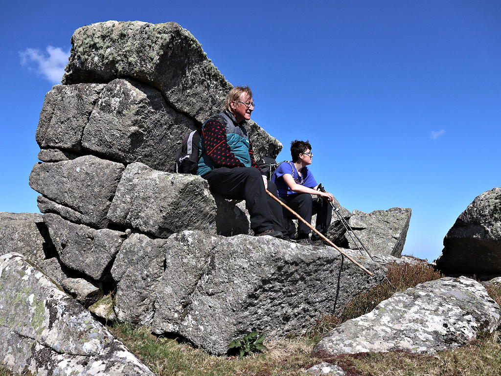 An edited version of this article appeared in Dartmoor Magazine - Winter 2011.It is very likely that hundreds of people will have walked the path to Buckland Beacon on South Dartmoor to view the celebrated Ten Commandment stones that have lain close to the summit at SX 735731 since c1928 without paying too much attention to the small tor that resides over the wall a short way to the east. 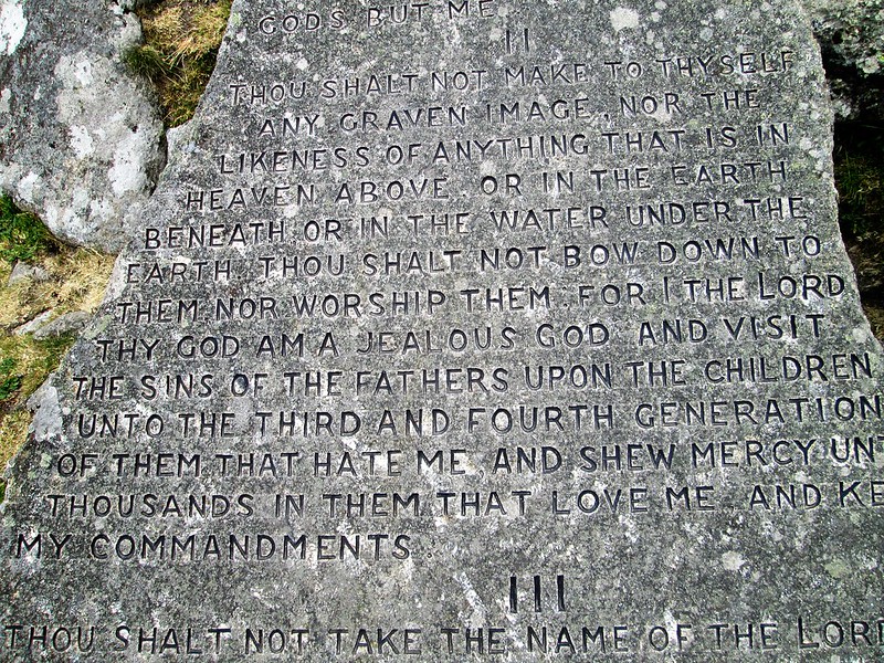 Buckland Beacon Ten Commandment stones The accounts of Welstor Common in Dartmoor literature are surprisingly scant with only William Crossing (WC) and Eric Hemery (EH) providing an indication of there being any rocks in the vicinity. Marked simply as 'Welstor Rock' on popular Ordnance Survey maps, implying a single entity, there is in fact two separate outcrops on this hillside, one of which the eastern pile has until now seemingly escaped description. 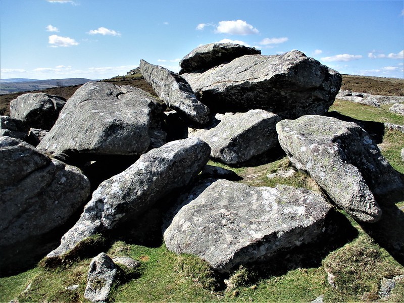 Welstor Rock OS version rock jumble In the 1912 edition of the 'Guide to Dartmoor' (reprinted 1993) Crossing reinforces the notion of a single rock at this point, for not only is it listed as such in his index, it also appears on page 346 where he describes a short walk to Buckland Beacon from Welstor Cross as follows; 'The road runs L (left) to Ausewell Cross but we shall keep R (right), or northward and speedily reach the commons which are here enclosed by a wall L. In this, however, there are three gates and on reaching the first we enter and pass up the slope W (west), with the Rifle Range R, to Welstor Rock. In front of us is another gate and on passing through this we shall find ourselves close to Buckland Beacon' It is the reference to the gate in the final sentence of this quote that indicates that WC was standing at the top part of the tor somehow having missed the more obvious rocks on the hillside that lie on the eastern side.  Buckland Beacon "Please shut the gate" Published some 70 years later in 'High Dartmoor' EH introduces the name of 'Wells Tor' (p 665) to describe the area. Also using 'Welstor Rock' in his account, he describes it as a pile that is 'completely in ruins' having 'shed its weathered slabs flat upon the ground' again giving the impression of a single outcrop here. Like his predecessor Hemery also refers to the nearby hunting gate. From reading their descriptions it is my assertion that both men were describing the upper and most western outcrop of the tor at SX 7368 7304 the one that is clearly visible over the wall from Buckland Beacon. This is indeed the most ruinous part, little more than a jumble of large boulders. 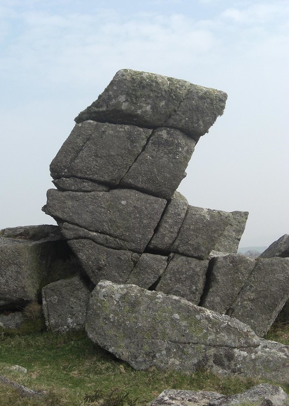 Wells Tor Stack (East) So why did neither author refer to the second and more robust outcrop at SX 7378 7296, that is little more than 100 metres to the east of here? Did either of them walk over the summit and down to the eastern pile, by their descriptions it seems not. Admittedly this part of the tor is not actually visible from the western rocks, but it is certainly more prominent when viewed from above and below and retains within it a curious weathered 'L' shaped central stack with deep fissures that zig-zag through the granite (see photo), beneath which on the south side a considerable rock field extends. Another possible reason for the lack of attention lies in the difficult terrain here that until relatively recently was choked with gorse making walking between the two outcrops virtually impossible. Swaling has now made the area much more accessible and now is the time to visit the forgotten stack of Wells Tor. Park up at Cold East Cross (SX 7406 7420) and walk south along the wall to Buckland Beacon. Wells Tor is over the wall to the east, appearing as a ruined tor from this point you will need to proceed downhill to see the much better-defined outcrop. References: |