TORS OF DARTMOOR
a database of both lesser- & well-known rocks and outcrops
Beacon Down RockBeacon Hill
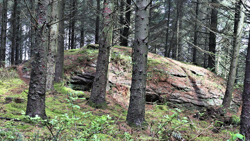 Special thanks go to Sam Henderson for alerting us to this outcrop located on the gentle slopes of Beacon Plantation. It is clearly visible on an Ordnance Survey map dated 1885, marked as a huge area of bedrock on the eastern spur of the down. It has long been apparent to the Tors of Dartmoor team that forestry plantations are unkind to the tors and rocks situated within them. These inhospitable environments often bury what were once prominent features; where decades of spruce needles haven't choked the soil, the oppressive darkness stunts all but the most resilient of flora and moss smothers both tree trunk and rock in equal measure to the point where it is difficult to discern the two. 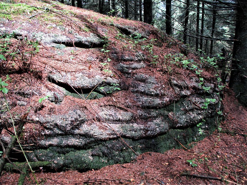 Those decades of aforementioned needles, coupled with the thorny tentacles of encroaching brambles, belittle the outcrop somewhat but this squat granite knoll is larger than first perceived and its footprint affords it some sunlight through the canopy. It rises to approximately two metres above ground, this height is viewed to better advantage on its exposed western/southern face where horizontal jointing is evident. Stepping up onto the top is simple from the gradual incline on its east side, where the bedrock is lost beneath a layer of moss topped with a sprinkling of cones and twigs. 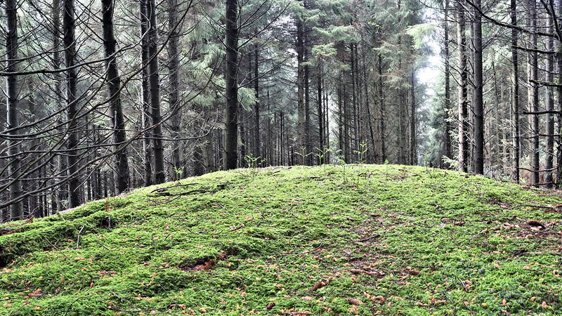 When visited by the ToD team in May 2021, the small blackened scar of a recent fire pit was noted on its summit. Whilst the charred earth is unwarranted its existence does draw attention to the fact that Beacon Down is said to be named after a medieval fire beacon that was once situated on the hill. It can't be confirmed with any great certainty where this was, but the granite here would have made a good solid base to manage a beacon without damaging the downland vegetation that once existed before the loggers desecrated it. A woodland archaeological survey of Kennick and Tottiford Woods in 1994 speculates a "Roughly central, large rocky outcrop in this sector may explain it's name: "Beacon Hill"?" Whilst not considered 'central', no other significant rock is visible in the area so this is likely the outcrop mentioned. 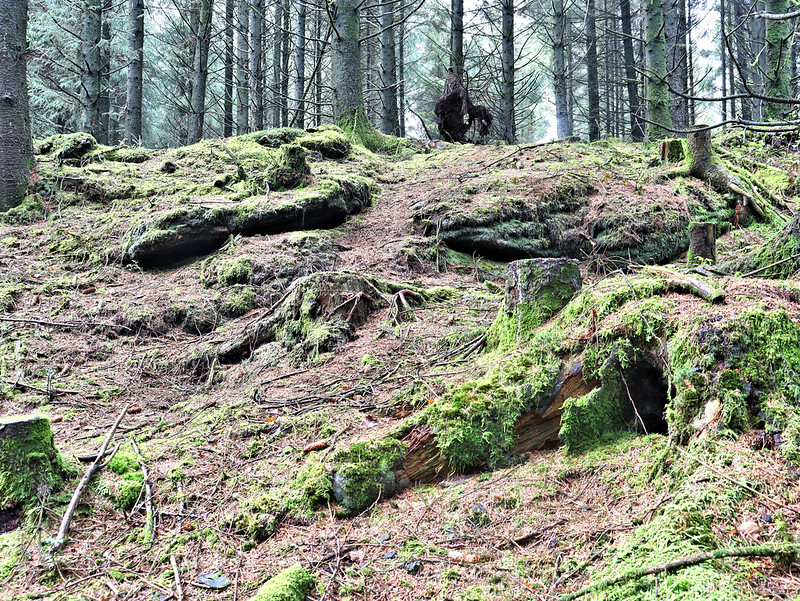 A few metres further east, more emergent granite can be seen lower down the slope. Whilst clearly related to the grander exposed rock above, the ground here is punctuated with tree stumps and subsequently unstable, unkempt, and unremarkable.
Please Support UsWe are proud to see the names of lesser-known tors are now being used more commonly on other websites and whilst this is to be encouraged we do request that, should you wish to use the information on this page, you provide a backlink to the website as reference, by copying the relevant address: https://www.torsofdartmoor.co.uk/tor-page.php?tor=beacon-down-rock Please also consider a small donation to the upkeep of the site; any contribution goes toward the fees to keep the database online and any costs incurred when undertaking research such as subscriptions to online archives. | ||||||||||||||||||||||||||||