TORS OF DARTMOOR
a database of both lesser- & well-known rocks and outcrops
Littorally Tor
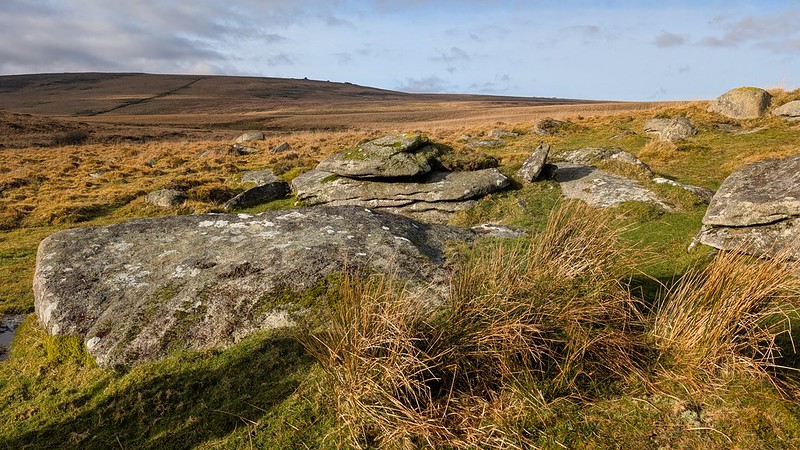 The very first Ordnance Survey map dated 1809, based on the surveys of Lt. Col. William Mudge, is said to have possessed a number of misnomers; 'Littorally Tor' to the west of Scorhill Down, 'Granate Tor' to the east of Corn Ridge, and 'Bag Tor' near Christow. After we re-discovered the existence of Bag Tor on Great Tincombes Hill, and a likely site for Granate Tor, we thought it was only right to investigate the case of Littorally in more detail. 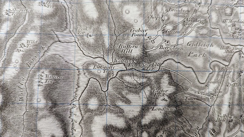 A search for literature evidence of an outcrop has, so far, proved unsuccessful. William Crossing, in 'Amid Devonias Alps' (1899), states; "There is some small difficulty in compiling a list of the tors of Dartmoor, on account of deciding what really are or are not such, several of the hills which have been sometimes reckoned as tors, possessing no crown of granite rocks to entitle them to that designation." It has long been considered that this could be the case in relation to Littorally Tor and so the name was never repeated on later maps. 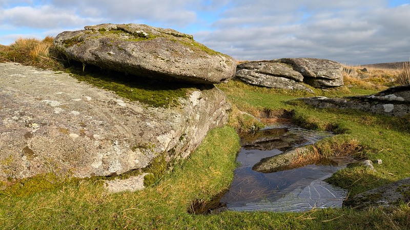 'Littoral' derives from the latin littoralis "of or belonging to the seashore", and it is the transitional area between dry land and open water - an intertidal zone that is sometimes above and sometimes below the water level. Whilst the location is non-tidal, it is nestled on the low land between the Walla Brook and the North Teign and the Ordnance Survey 1:50,000 map of the area still shows a clitter-like formation spanning both banks of the North Teign so this could be considered a description for the terrain. 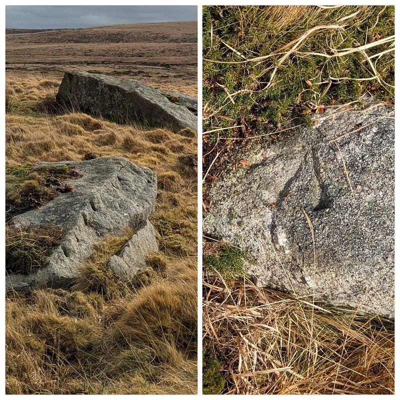 As for evidence of a 'tor' itself; a collection of lowly emergent bedrock can be found at SX 6463 8676 on the south flank of the "little rising ground". The visitor will find signs of early industry; the split marks of feather and tare on the granite, likely a resource to be used at the nearby tin streaming works on the North Teign to the south-west, which may explain why the area was given a name. There is also added interest in an OS benchmark at SX 64591 86818.
| ||||||||||||||||||||||||||||||