TORS OF DARTMOOR
a database of both lesser- & well-known rocks and outcrops
Manga Crag
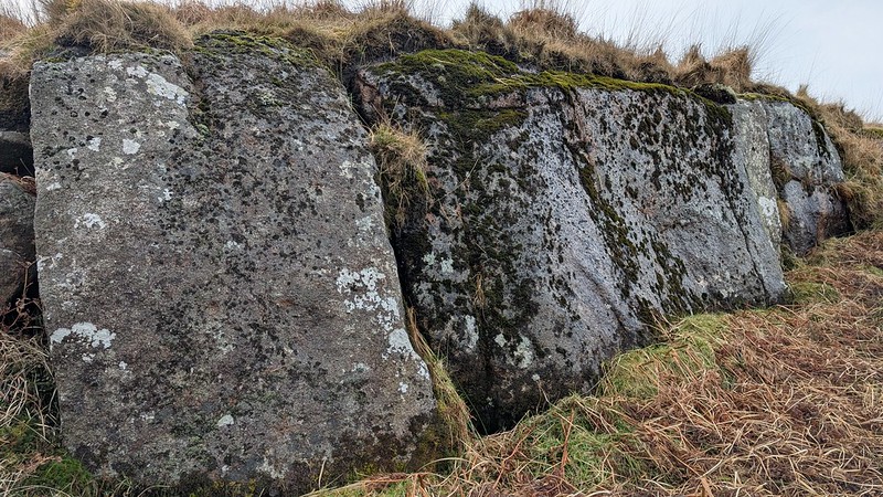 There is so much to admire about the moorland course of the North Teign River. From its source at Teign Head (GR SX 61435 83996) the infant stream rapidly gathers pace and the valley sides steepen beneath Teignhead Farm. It is crossed by two splendid clapper bridges, the first ranking among the finest on the entire moor, and the second a restored bridge in memory of well-known Dartmoor writer and tour guide F.H. (Harry) Starkey (1912-1989), set up after his death in the 1990s. A short way below Starkey's Clapper the river abruptly drops away into Manga Hole, where the water cascades over massive granite bedrock. This spot, hidden from even some nearby vantage points, is interspersed by stunted oaks, moss and ferns and is a scene of beauty. 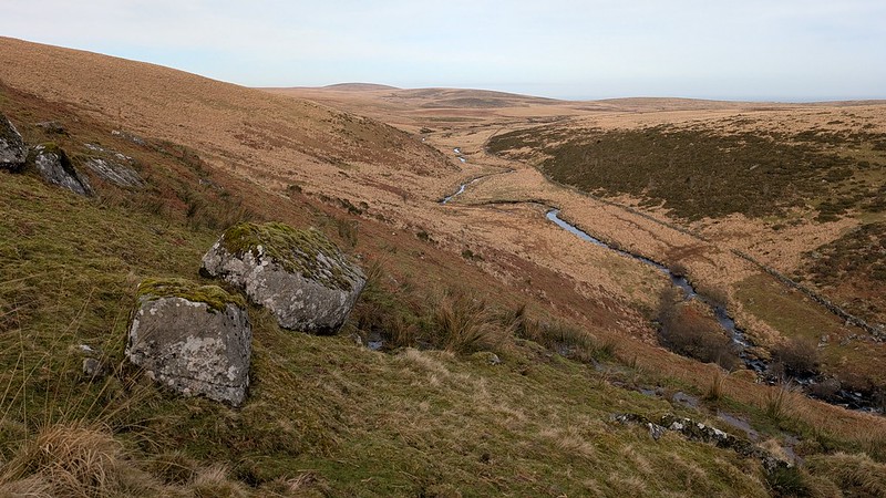 The best place to view the Hole is on the extremely steep declivity of Manga Hill's eastern shoulder, at a small ridge of rock that the Tors of Dartmoor Team have tentatively called 'Manga Crag'. It is a conspicuous landmark when seen from Manga Rails to the north and Langridge (Long Ridge) to the east, especially when the sunshine catches the fringe of the Crag. It appears as a wall of rock edging from the brow of the hill and has clearly been worked for stone. Rob Naylor of the Dartefacts website first noted the outcrop it seems, recording that the Ordnance Survey depict a 'cliff' of rock here on their 1:25,000K maps. 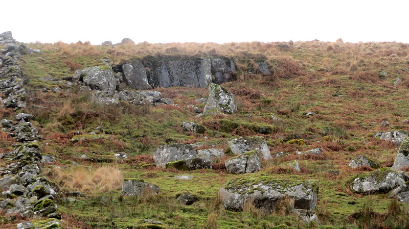 Manga Crag is located just below the point where a newtake wall turns a corner; it was no doubt built utilising granite from here as there is a sprawl of large boulders under the main face of the Crag. Manga Hill itself is a large plateau of soggy moorland, but it is not devoid of interest and its environs are of merit; not least Manga Farm, set into the hillside, which lies about 250 metres to the south of the Crag. This is best reached from the aforementioned clapper bridges and you can scale the slope to follow the old, wide, grassy drive known as 'Manga House Lane'. Hemery (1983) pictures the scene: "Mounting the flank of Manga Hill diagonally, it appears to the ascending traveller to vanish into the clouds; its terrestrial destination, however, is Manga House, a ruined farm that has always for me been one of Dartmoor's most intriguing, not least for its fine situation on a valley-side shelf: the Teign basin backed by Cosdon comes into view ahead, while in the opposite, southward direction, the more distant southern heights form a backdrop to the Grey Wethers circles, which appear from this point like a concourse of people." 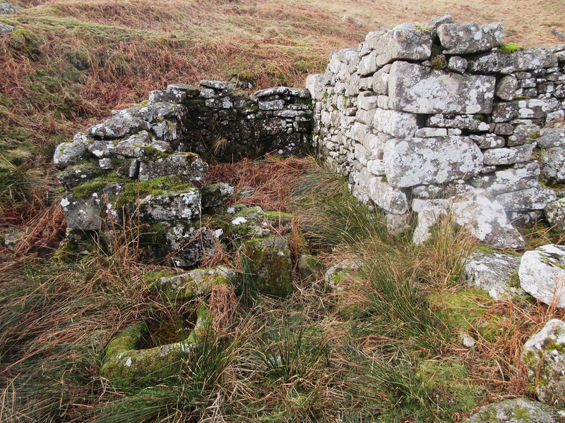 We learn from Elisabeth Stanbrook (1994) that William Crossing, in his book Guide to Dartmoor, incorrectly sited Manga Farm (or 'Mandles', as he called it) at Great Varracombe (which is a kilometre or so to the south-west). Stanbrook further explains the confusion: "Initially, Manga Farm was called Varracombe and, at some time after 1829, became known by its familiar name, although it was often documented in records as Teignhead or Teign Farm due to its being a part of the Teignhead enclosures. "Manga" was undoubtedly adopted for the farm because of its close proximity to Manga Rock, Manga Brook, Manga Hole and Manga Ford." The old farm is well worth a visit; if you look closely in the rubble there is a superb granite trough still capturing water, as well as an old door lintel close by and fine gateposts in the surrounding walls.
| ||||||||||||||||||||||||||||||