TORS OF DARTMOOR
a database of both lesser- & well-known rocks and outcrops
Milfordleigh Rocks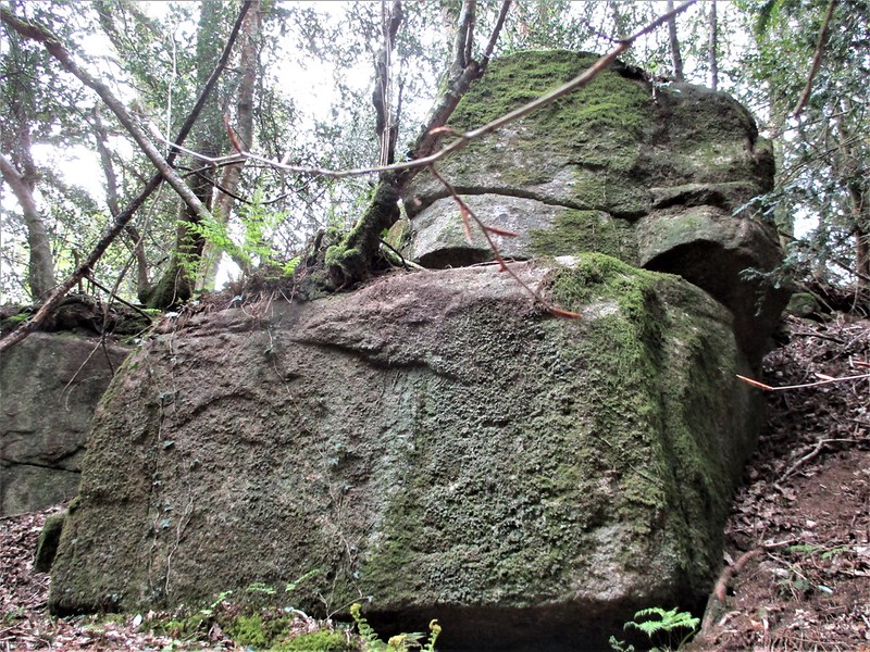 About one mile to the west of Chagford a short way to the north of the River Teign lies the peaceful 17-acre Milfordleigh Wood that was once part of the St Olave's Estate. It is shown as a Plantation on the Ordnance Survey (OS) map of 1884 and is nowadays managed by the National Trust who acquired it sometime between 1954 and 1971 when the Estate was broken up and parts of it sold off (Chagford Local History Group). 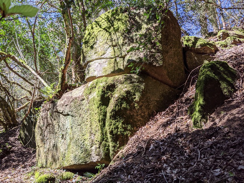 Inside the Wood and a little way to the north of the main path that leads eastward from Leigh Bridge stepping stones at SX 683876, there are some interesting rocks scattered across the slopes culminating in what appears to be a decent sized stack some thirty metres or so above the path. Here there are two large rocks one propped on top of the other with another one beside forming a tall 3-metre-high feature on the south side that is quite impressive when viewed from beneath, the group here first noted by Max Piper in April 2021. Unfortunately, there is little to see from the rocks as the trees conceal most of the views around, as a result the area is rather shadowy and secretive and for that reason the rocks can be easily overlooked as they are not immediately evident from below, so you have to search them out, but they are not disappointing. 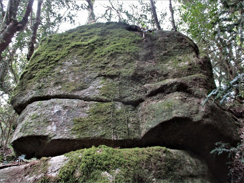 The preferred route would be via a footpath (known as Leigh Lane) that leads down from the hamlet of Higher Murchington to the north and takes you to a stile beside a gate that enables access to the top part of Milfordleigh Wood. However, to see the stepping stones that are strangely omitted from OS maps, walk past this entrance, and carry on down the narrow lane to the right. Soon on the left you will note a small gap in the wall that will provide access to the Wood after inspection. 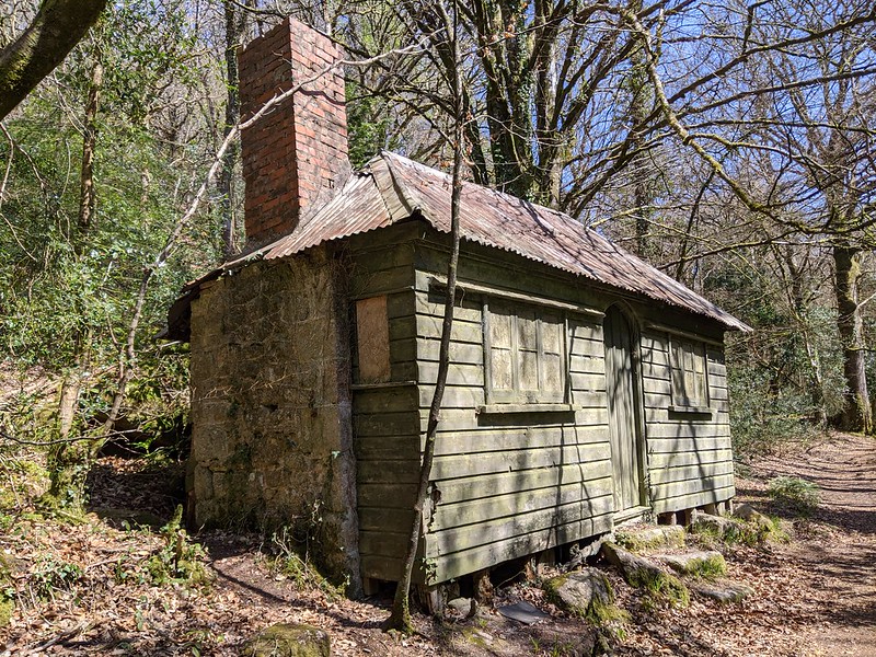 Whichever route you choose if entering the Wood from the west you will need to walk east for about 250 metres or so passing on the left a curious wooden building with a tall brick chimney and corrugated roof that is described by Elliott and Lawrence (2021) as a 'fishing hut' built during the days of the Estate. As you walk through the trees there are glimpses first of Leigh Bridge to the right and across the river into the private gardens of Puggiestone, the dwelling taking its name from the large outcrop there that is said to have a rock basin atop (see Puggiestone). After viewing Milfordleigh Rocks, you will need to retrace your steps in a westerly direction along the path to return to Leigh Lane and then back up to Higher Murchington.
| ||||||||||||||||||||||||||||