TORS OF DARTMOOR
a database of both lesser- & well-known rocks and outcrops
Narrowhole Rocks
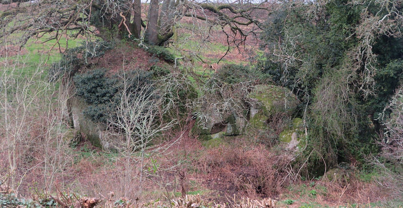 When walking along the roads of East Dartmoor it is not uncommon to spot outcrops of rock that are sited in the middle of fields, some quite obvious, and others that are hidden under a dense woodland canopy. It is this fantastic rock-strewn landscape that makes the East so special and memorable to visitors. 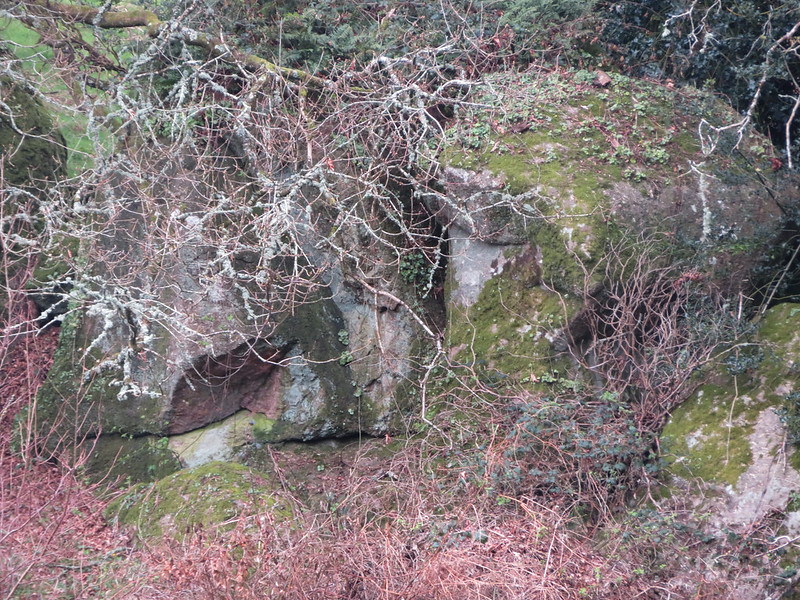 This rockpile can be found literally on the edge of the granite pluton to the west of the A382 at King's Cross and it seems that it has not acquired a name until now. Here we have two main boulders that are topped by ivy near the bottom of a steep hill where bracken wraps itself around the base of the granite. 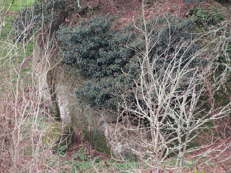 Spotted by Dartmoor Guide and Editor of Dartmoor News Paul Rendell in February 2021, the Rocks are to be found on private land, however you can obtain a good view in winter months from the aforementioned Cross to the east. A recent visit in April 2021 uncovered evidence of a fire on the hillside that has revealed more of the Rocks to the public eye. 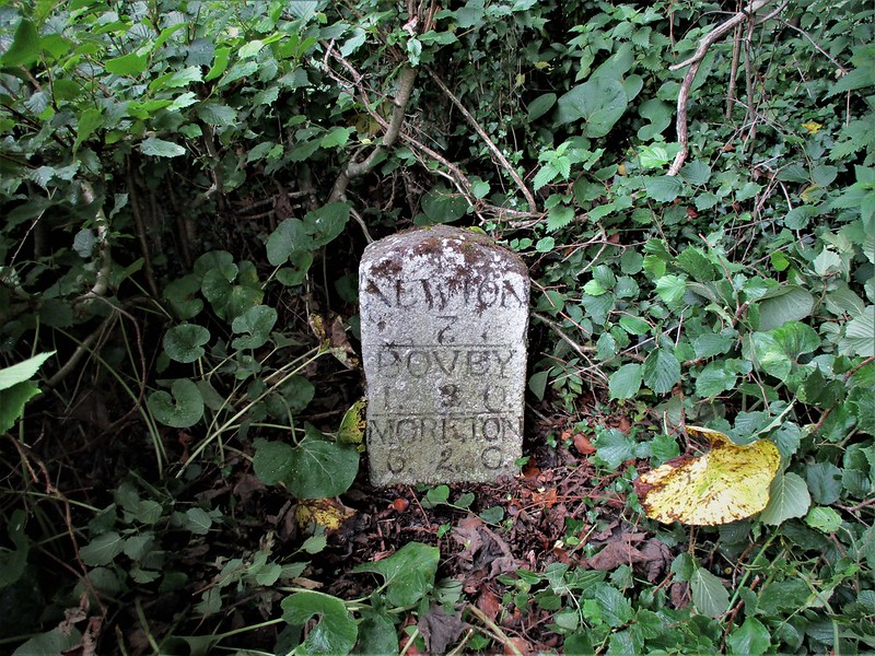 The Tithe Map of the Parish of Bovey Tracey, dated to the 19th Century, names this plot of land (691) as 'Narrowhole' which seems a most appropriate appellation to describe the small tor here. Old Ordnance Survey Maps indicate a sizeable outcrop, too, along with a milestone to the north of the junction with Forder Lane that gives distances to Moretonhampstead, Bovey Tracey and Newton Abbot respectively that are measured in miles, furlongs and poles. A Dartmoor National Park boundary marker can also be seen at King's Cross, but it should be noted that the A382 is a notorious road with sharp bends and the visitor should be vigilant when viewing Narrowhole Rocks and inspecting the inscribed stones.
| ||||||||||||||||||||||||||||||