TORS OF DARTMOOR
a database of both lesser- & well-known rocks and outcrops
South Park Tor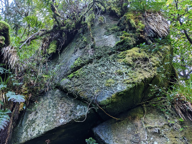 In the latter part of 2020, Dartmoor Guide Paul Rendell, with kind permission from the landowner, explored the woodlands either side of the North Teign River below Gidleigh Tor, that are collectively known as 'Gidleigh Woods'. He unearthed numerous rockpiles and in the far westernmost part of the complex, to the south of the river that is called South Park, there is a tor of considerable dimension. 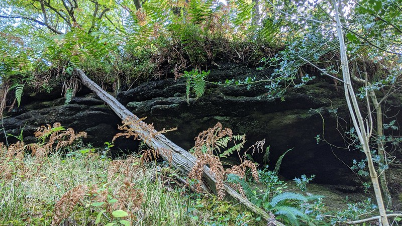 Arriving at the summit of the tor, at a grid ref of approx. SX 6661 8753, you will notice a couple of moss-clad rocks; apparently insignificant, but they herald the start of a splendid tor, and a short way below here can be seen a larger, overhanging rock that protrudes from the side of the hill which is noted for being heavily dressed with grass and bracken on its top. Carefully dropping down the hill, ducking under and around tree branches, you will stumble across the middle section, at SX 66629 87586; this presents as an imposing wall of dark granite that is decorated with a fringe of dangling plants. 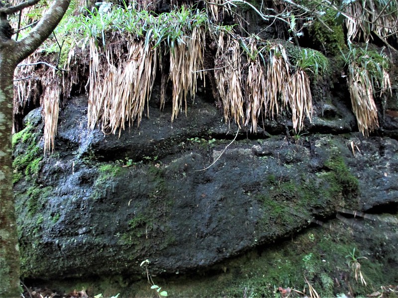 The terrain below the middle pile is quite problematic, inundated with dense bracken and loose branches as well as the incredibly steep and slippery gradient, caution is a must for those venturing this close to the river. A narrow passage leads to the lowest rockpile at SX 66619 87595, and this is easily the most impressive part of the tor. It is like a lost world down here where the rocks, some of great size, have tumbled down the slope but it is not until you are below or beside them that they are visible; caves and crevices, some large enough for a small person to find shelter, are found in small pockets throughout the bottom of the wood but the best aspect is a huge, contorted stack of rock that rises to between 15 and 20 feet high. Tangled, gnarled, and enriched by moss its position this far down the hill has ensured that the surrounding flora has thrived. The only way out from here necessitates heading back up to the middle pile to avoid the unstable ground and the somewhat claustrophobic atmosphere adjacent to the river. 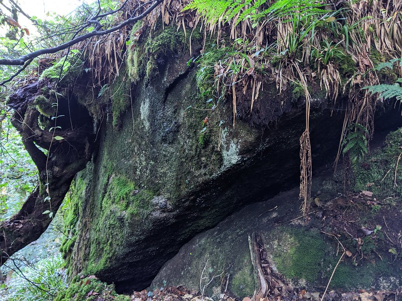 South Park was felled quite recently at the time of writing in October 2021 which resulted in considerable damage to some of the outcrops to the east, but fortunately the far north-westernmost area was virtually untouched by the works and so we are left with a magical tor that just gets better the more of it you explore. Please be mindful that with the exception of the public footpath about half a kilometre to the east, South Park is entirely on private land and permission must be sought from the landowner before you visit.
| ||||||||||||||||||||||||||||